
Tweed Council places a 20 year moratorium on any dam proposal at Byrrill Creek effective from 15 May 2012.
The Save Byrrill Creek Campaign does not endorse the raising of the dam wall height of the Clarrie Hall dam as an alternative to building a new dam at Byrrill Creek. We are opposed to both dam options and any further erosion of the Tweeds bio diversity, further loss of habitat for threatened species, flooding of Aboriginal sites, fragmentation of wildlife corridors, destruction of endangered ecological communities and the inundation of lowland rainforest in Mebbin National Park which also includes the loss of the access to the National Park for tourists. We are also concerned for the spiritual integrity of the whole Mt Warning complex and the web of Songlines.
It is also worth noting that the largest housing estate that the Tweed has ever seen costing $3 billion at Cobaki is going ahead without dual reticulation recycling or stormwater harvesting and recycling or large rainwater water tanks. Because no water saving initiaves are being employed, some Tweed Councillors are still pursuing a dam at Byrrill Creek.
-
Byrrill Creek is situated on the South Western side of Mt Warning near Murwillumbah in the Tweed Shire in Northern NSW. Byrrill Creek feeds into the South arm of the Tweed River.
-
The existing Clarrie Hall dam on Doon Doon Creek which also feeds into the South arm of the Tweed river is only 6.5 km away and was built in 1981 to provide the water needs for a population of 160,000.
-
A second dam on Byrrill Creek will destroy sites of the Highest Conservation riparian status in the Tweed.
-
There are potentially 45 species of threatened animals likely to occur within the area to be inundated, 15 of which are species restricted to lowland rainforest/wet sclerophyll habitat areas.
-
In addition to the threat of localised extinctions there is also the issue of disruption of habitat connectivity and of gene flow.
-
There are at least 26 species of threatened plants likely to occur within the area to be inundated.
-
Of these, 20 are species restricted to lowland rainforest on alluvial/basaltic soils and listed as Endangered for purposes of the Environment Protection and Biodiversity Conservation [EPBC] Act.
TWEED COUNCIL MEETING 10th DECEMBER 2015
At last night's Council meeting we resolved on a negotiated position to address Tweed's future Water Supply.
The following Mayoral Minute was passed on the casting vote of the Mayor Katie Milne.
Councilors supporting the motion were K Milne, G Bagnell and B Longland.
Councilors against the motion were W Polglase, P Youngblutt and C Byrne.
Mayoral Minute Water Supply Augmentation
1. Based on the information currently available, Council adopts the raising of the wall of the CHD as the preferred option for future water security and proceeds with the planning approval & land acquisitions phase for the project.
2. Concurrently a comprehensive independent review of Council's Water Supply-Demand options is undertaken as a matter of priority, to ascertain further consideration of the most ecologically sustainable, climate change resilient, cost effective and socially acceptable long term water management and augmentation options available. Such a review should include, but not be limited to, a full range of demand management, drought security, and supply options.
3. The community working group that was previously established to consider the water augmentation options be reconvened (with the exception for new Councillor representatives), to recommend the terms of reference for the review, recommend the selection criteria and weightings for selecting a preferred consultant for the review, and as a project reference group for the review.
The rescision motion to remove the 20 year Moratorium on a dam at Byrrill Creek was defeated by the withdrawal of support for this motion by Councilor Longland and with the Mayors casting vote.
Councilor Byrne withdrew her proposal to approve preliminary plans to move forward on both Byrrill Creek Dam & the raising of Clarrie Hall Dam Agenda Item 32 Page 213
GOOD NEWS -THE MORATORIUM FOR BYRRILL CREEK REMAINS!
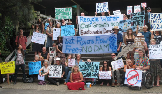
It has been a very challenging week leading up to the Council meeting on Thursday 10th & ultimately a great outcome.
Thanks to all those who addressed Council at Community Acess, wrote emails, letters, phonecalls etc & who came to the Meeting.
It has taken a lot of negotiating to come up with this result.
It may seem a step backward supporting the raising of Clarrie Hall Dam (1 dam is better than 2), however we will concurrently now have a New Independent Review on all water options with input from the CWG Group ( Community Working Group) to explore sustainable solutions.
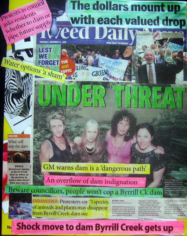
TWEED STEPS AWAY FROM ECONOMIC AND ECOLOGICAL IRRESPONSIBILITY
Media release: 11 December 2015: Dr John Kaye NSW Greens
The decision by Tweed Shire Council to abandon plans to lift the moratorium on building a dam on Byrrill Creek is a great victory for households, the community and the environment, according to Greens NSW MP John Kaye.
Dr Kaye said: "A Byrrill Creek dam would have been the very worst option.
"It would have been both economically and environmentally irresponsible to push ahead with it.
"A lot of hard work clearly went into negotiating a very constructive outcome.
"The Tweed population has been well served by those who showed the flexibility and depth of understanding to step away from the Byrrill Creek option and to push ahead with an independent review of the options.
"Raising Clarrie Hall Dam would be a far less damaging project than the Byrrill Creek proposal.
"However it should still be assessed against other less damaging water management options before any money is committed to it.
"Tweed households should not have to pay for any dam they don't need. When there are lower cost alternatives, they should be fully developed before any money is spent on large-scale construction.
"The review is likely to achieve a much more credible and lasting outcome with the reconvened Community Working Group playing a key role in developing the terms of reference and the selection criteria for the consultants.
"It's a great testament to the Tweed community and their political and campaigning skills that they can turn around what looked like a certain loss into a big step forward for water planning in Northern NSW.
It's also a testament to those who voted with Mayor Katie Milne to take Byrrill Creek off the agenda."They have proven their ability to listen to the community and their commitment to a robust water plan that will protect household budgets and the environment," Dr Kaye said.
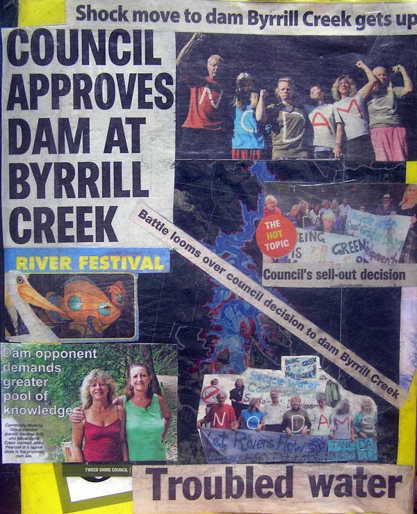
DECEMBER 2015 MORATORIUM ON BYRRILL CREEK DAM MAY BE RESCINDED
COUNCIL MEETING THURS DEC 10TH
Cr Barry Longland, Byrne & Polglase have proposed a rescision of the 20 year Moratorium on Byrrill Creek at the Council Meeting Thursday 10th Dec
Council Meeting Thursday 10 December 2015 Agenda Item 31 Page 212
Byrrill Creek Dam Site
Councillor C Byrne, B Longland and W Polglase hereby give notice that at the next Ordinary meeting of Council we will move that the resolution from the meeting held on 15th May 2012 at Minute No 314 Item No 49 title Cr D Holdom] Byrrill Creek Dam Site
Moratorium being:
"that Council places a moratorium on any dam proposal at Byrrill Creek for a period of the next twenty (20) years, effective from 15 May 2012. " be rescinded.
Cr Caroline Byrne has also proposed to approve preliminary plans to move forward on both Byrrill Creek Dam & the raising of Clarrie Hall Dam
Agenda Item 32 Page 213
| http://www.tweed.nsw.gov.au/Controls/Meetings/Documents/CouncilAgenda10December2015.pdf |
COUNCIL MEETING 19th NOVEMBER 2015
Tweed Council Staff Report recommending the Adoption of the Raising of Clarrie Hall Dam as the preferred Water Augmentation.
Its item 24 on the Agenda Staff Report:
http://www.tweed.nsw.gov.au/Controls/Meetings/Documents/CouncilAgenda19November2015.pdf |
Item 24 [E-CM] Water Supply Augmentation - Selection of Preferred Option page 129-146
Also Attachment 1 - Water Supply Augmentation (Below Agenda)
Also Hydrospheres IWCM Report Link-
| http://www.tweed.nsw.gov.au/Download.aspx?Path=~/Documents/Water/Water%20Efficiency/TSC05569_Integrated_Water_Cycle_Management_Strategy_2014.pdf |
Result of Council Meeting
The Council defers the decision until the February 2016 Meeting.
A series of Workshops be held for the stakeholders and Community prior to this.
A copy of a presentation to Council at Community Access on Nov 19th by Joanna Gardner is available here
| The Community does care a Damn |
Environmental Effects of the proposed Dam
The area in the vicinity of the proposed dam is comprised of Myrtaceous Riparian Low Closed Forest to Woodland which is classified within a Rainforest category & occurs as a Riparian Community. It comprises a low closed riparian forest to woodland community found in a relatively narrow band fringing creeks or in gully sites within sclerophyll forests. Tweed Veg Management Strategy allocated it a High Conservation Status 2, which is considered rare, comprising less than 0.7% of all bushland, with most of the best examples within Byrrill Creek.
In the Tweed Riparian Restoration Prioritisation Report, of the 6 subcatchments of the Tweed, 86 sites were surveyed & ranked. Byrrill Creek ranked the highest Conservation Value, with an average 70% and Diversity, 79%. Within the top 30 high priority sites,10 are in the BCk catchment. Most of these sites (except Cedar Creek sites) will be affected by the proposed dam site. Of particular concern is Site Rank 4 (BYBY2), which is within the proposed dam wall construction site & runs 300metres upstream of the dam site. Another site, (BYBY4), ranked as number 1 priority within the Tweed, is approx 800 mts downstream of the dam wall and would be severely affected by reduced water flows of the dam upstream. Further sites downstream would not be as severely affected as Cedar Creek would provide extra water flow. Be that as it may the whole riverine eco system of Byrrill Creek would be affected by the proposed dam. The dam wall site is at the northern end of a beautiful natural lagoon, where daily sightings of platypus occur. The entire length of Byrrill Creek is a prime habitat for platypus.
Impacts would fall into different categories:
-
Construction related: Widening or damage to existing access roads & surrounding vegetation, Heavy machinery, cement works, pipes, traffic, noise, air pollution, resource use, green house gas emissions
-
Dam wall Site & construction zone: Complete eradication of existing land & river features and destruction of habitat and species.
-
The catchment area of 400ha would be clear felled of existing trees & vegetation up to the 125 mt contour mark to ensure water quality in catchment, again total loss of habitat & profound affect on all species
-
Inundation of the area; the land lost, and all of the ecological, social, cultural, economic and climate impacts associated with this.
-
Hydrological Changes: the impact of water being retained by the dam & the lack of water available to the natural environment downstream with changes to flow rate, frequency and duration and water quality, especially until levels within the dam reached spillway level. At present Byrrill Creek is rated as category U4, being of low environmental and hydrology stress, due largely to the low levels of water extracted from the creek. (Stressed Rivers Assessment Report.)
-
The dam wall would be a barrier to fish, eels, platypus, turtles and other aquatic species & interrupt migration and breeding patterns
-
Species that live within the riparian zone, from insects, to frogs, platypus or vegetation along creek banks, would have to adapt to new conditions, but many may not be able to.
-
Erosion downstream could be exacerbated by the dam wall, as it would prevent natural migration of silt downstream during floods & heavy rains.
-
Looking at the larger environmental picture of the Upper Tweed River, if a dam was built at Byrrill Creek, it would mean 2 dams in adjacent catchments on this stretch of the river, which is already rated S3: High Hydrological stress & Medium Environmental stress (Stressed Rivers Assessment Report.) The reduced flow into the upper catchment of the Tweed would further degrade the quality of an already stressed river.
Aboriginal Heritage Sites within the Catchment Area
There are several sites of Aboriginal Cultural significance on the Council land, which would be inundated. Sites include: a ceremonial site, camp site & burial stes. It is interesting to note that when Boodjeragali', an Aboriginal Organisation, applied to Council to look for cultural artefacts on their land in 2002 they were denied access.
The Bigger Picture
The Byrrill Creek area is geologically part of the inner dyke complex of the Mt Warning Massif. As a World Heritage listed area, scenically beautiful, it comprises the southern side of Wollumbin, a spiritually significant site to the boriginal people and to residents who live in its shadow. Residents & tourists could no longer travel in a scenic circuit around Mt Warning as there would probably be no access. A dam would destroy the integrity of the whole mountain complex'.
Toxicity within the Catchment
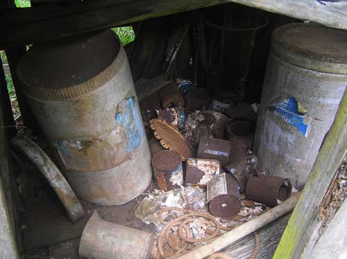
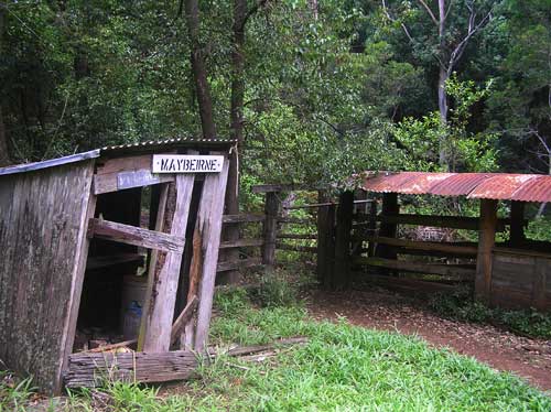
Dip Sites within the Catchment
There are 2 abandoned Dip sites within the proposed catchment area. The Byrrill Creek Dip at the eastern end of the Council land and the Maybeirne Dip at the western end. Toxic chemicals (many banned these days) may have leached into the surrounding soil and ultimately pollute the water quality if the dam is approved. Uncle Harry Boyd was concerned about the Dips at the Uki Water Options Meeting.
Spraying of Groundsel & other weeds
For many years from 1984 council commissioned their land to be sprayed with 24D and 245T, the active constituents of Agent Orange, which would have residual effects in the soil, and affect water quality.
Impact of a Dam on Byrrill Creek
Impacts would fall into several categories:
-
Construction related (traffic, noise, resource use, air pollution and many others)
-
Footprint (the immediate land taken up by the dam wall/construction zone and effects on habitats and species and people )
-
Hydrological (impact of water being held back in the dam the lack of water available to the natural environment, and changes to flow rate, frequency and duration and water quality)
-
Inundation (the land lost, and all of the ecological, social, cultural, economic and climate impacts associated with this)
Hydrological changes and inundation associated with a dam obviously have profound impacts on the ecology of a waterway both upstream and downstream of the wall. All aquatic and riparian organisms are adapted to the flow regime within which they are found, as flow predominantly defines the habitat type. This statement applies as much to a small aquatic invertebrate living on the underside of a rock as it does to platypus or the type of trees lining the banks of the stream. Some organisms have a broad range of tolerance, that means, they can live almost anywhere, but others are very specific. In high conservation value environments with high biodiversity, like Byrrill Creek, it is common to find a large number of organisms with very specific habitat requirements.
- If it is assumed that construction of a dam on Byrrill Creek would substantially reduce flow in the creek, certainly within the early period while it fills, it can be assumed that there would be similarly scaled impacts on biodiversity.
- Once the dam is full, or partially full, it is assumed that an environmental flow release will be implemented. This may be successful in restoring a semblance of the natural flow regime, and depending on the magnitude of change and availability of refuge habitats, there would be some recolinisation of the affected channel.
- The presence of a dam wall would act as a barrier to migration by certain species.
- The dam wall would entrap sediment being washed down from the headwaters and could lead to an increase in downstream erosion.
- Inundation of the creek upstream of the dam wall would affect species in this area as much as downstream.
- Inundation of large amounts of vegetation has been reported to lead to significant export of methane to the atmosphere as the organic matter breaks down via anaerobic decomposition.
- New habitats will be created upstream of the dam, favouring a different suite of aquatic and terrestrial species.